Drone Survey – Proserpine River
DATE: 1st July 2024 through to 30th June 2025
EXPENDITURE: $15,000
The Trust completed a LiDAR survey by drone which extended for approximately 4.4kms downstream from the start of the levee system.
The Trust took on this project to establish an initial base survey along the Proserpine River for use in forward planning of works and to assist in identifying critical areas for maintenance and or repairs.
The survey will also provide an initial base snapshot of the current state of the river-banks that can be utilised to assess changes over time or after major flow events in the future.
Thanks to the State Council of River Trusts Queensland, land holders, and contracted operators
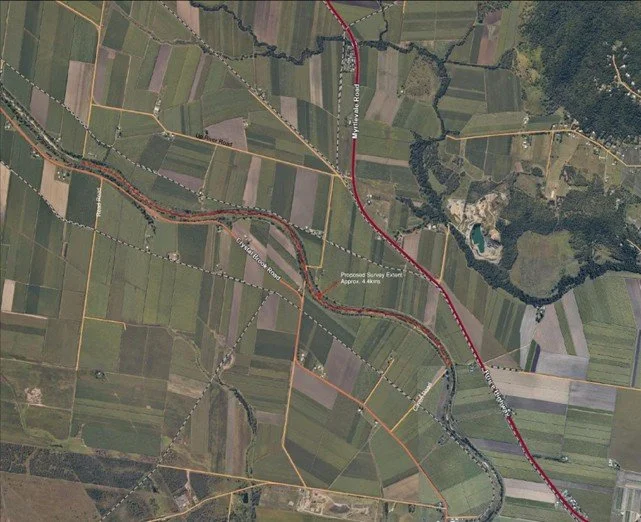
Image of the initial extent of the survey coverage